Project Intent
The Open Space Corridors Project is one of the City’s initial steps to protect and enhance the City’s valuable open space lands and to position the City to achieve its vision.
"Tacoma is green. We have ensured the long-term health and quality of our community through protection of our natural environment, preservation of our tree canopy and responsible use of our natural resources. We live within the capacity of our natural systems, ensuring long-term environmental sustainability."
From Tacoma2025, the City’s Ten-Year Strategic Plan
This project will be completed in phases, with the first phase consisting of updates to the City's critical areas for Biodiversity Corridors. This step will make significant progress toward preventing further fragmentation of some of Tacoma's most valuable natural assets.
Current Status
Shoreline Master Program updates (2019)
On September 24, 2019 the City Council adopted Ordinance No. 28612, enacting a package of changes to implement Tacoma's Shoreline Master Program Periodic Review updates. The package includes measures integrating the city's Biodiversity Corridors/Areas code into Shoreline Districts.
City Council action (2018)
On June 26, 2018 the City Council adopted Substitute Amended Ordinance No. 28518, including changes to the Critical Areas Code establishing standards for Biodiversity Corridors/Areas as a subset of current standards for Fish and Wildlife Habitat Conservation Areas, to provide more protection for these areas. See Exhibit 5 to the adopting ordinance.
Planning Commission recommendations
On May 2, 2018 the Planning Commission forwarded a package of recommended code changes as part of the Open Space Corridors - Phase 1 Project. The planning process is summarized in the Findings and Recommendations Report, and the recommended code changes are contained in Exhibit 6 to that report.
The Planning Commission conducted a public hearing on April 4, 2018 concerning the 2018 Amendments package (including the Open Space Corridors Project as one of the applications) and is expected to make a recommendation to the City Council on May 2, 2018.
Posted below for reference is the Public Hearing Notice. Also posted is the Open Space Corridors section of the public review document, which includes staff analysis report, proposed code changes, code overview, best available science summary, and map folio.
Prior to February, the Planning Commission had reviewed the subject on January 17, 2018 and gave direction on the proposed Biodiversity Corridors/Areas regulatory approach. Prior to that, the Planning Commission had reviewed the subject on December 6, 2017 and gave direction on the project schedule and scope. The focus of the current phase would be on updates to the City’s critical areas regulations pertaining to Biodiversity Corridors and steep slopes. Updating these critical areas standards would be an effective method to limit fragmentation of many of the most connected segments of the City’s Open Space Corridors.
Expected Completion
June 2018
What Areas of the City Are Designated as Parks and Open Space?
(Click the image to enlarge the map.)

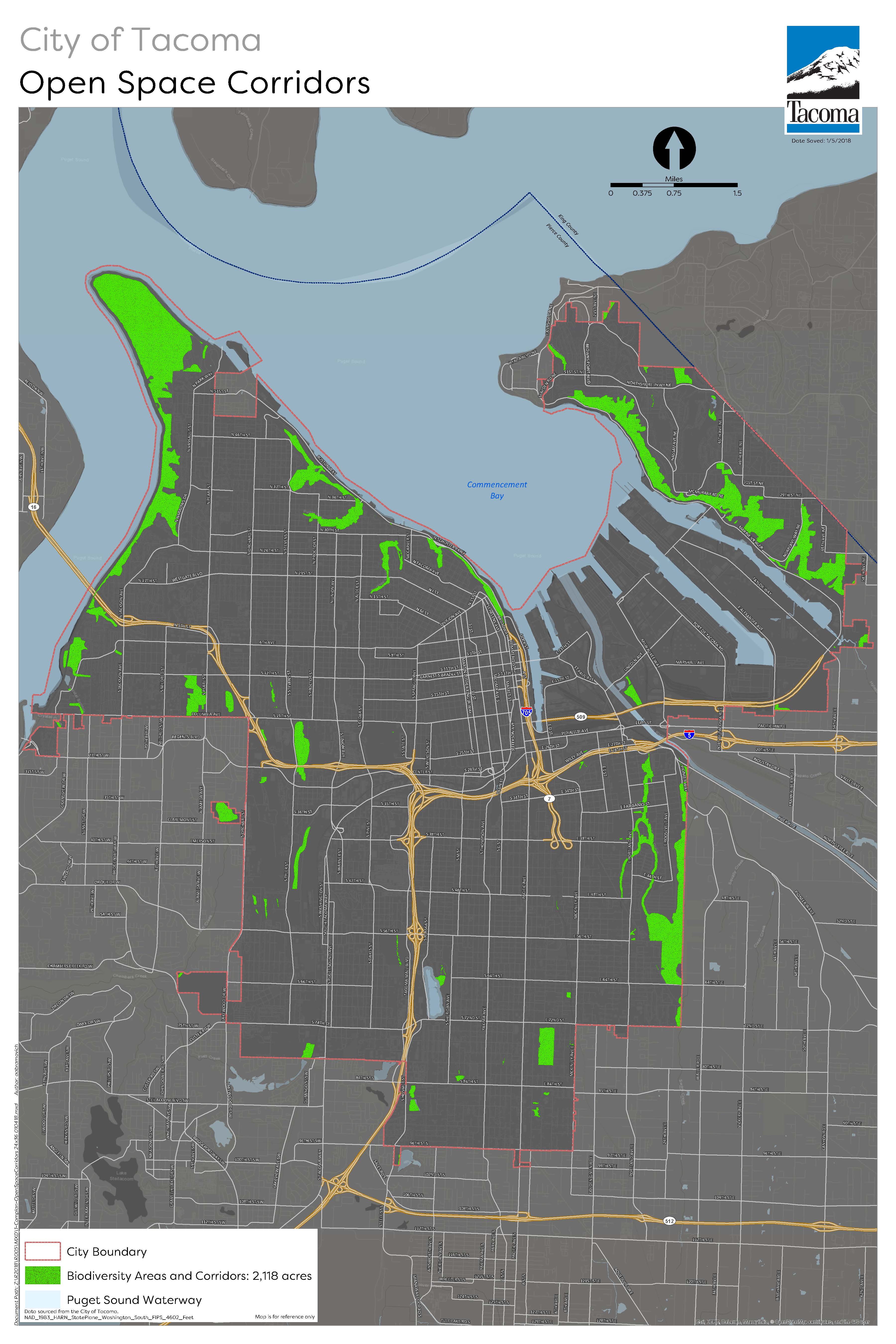
Proposed Biodiversity Areas and Corridors
(Click the image to enlarge the map.)

Interactive Biodiversity Corridors/Areas Map
(Search by address to see where Biodiversity Corridors/Areas are located citywide, along with other critical areas, land use and zoning, and parks and open space information.)
Project Materials for Public Review
Other Background Resources